3 days in Jeju, and the two things to sort before you fly
Jeju is a volcanic island 73 km across with its sights scattered around the rim, so how you move matters more than what you see. Two things decide your trip and both have to be handled before departure: whether you can legally drive, and whether you want the Hallasan summit.
![Manjanggul Lava Tube [National Geopark]](https://tong.visitkorea.or.kr/cms/resource/55/3354155_image2_1.jpg)
- Driving licence: you need your home licence plus an International Driving Permit plus your passport — all three, physical copies. An IDP on its own is not valid, and photos of documents are refused.
- Hallasan summit: free, but the summit sections are capped and must be reserved. Bookings open on the 1st of each month at visithalla.jeju.go.kr.
- Typhoon season runs late June to early October — flights and ferries cancel en masse. October and November are the island's best months.
Do you actually need a car?
Not strictly — but it roughly doubles what you can fit into a day. Buses reach the headline sights on a decent frequency; they do not reach the oreum, the coastal cafés, or most viewpoints, and rural routes can run three or four times a day.
| Renting | Budget ₩120,000–160,000 a day all-in for a mid-size car in shoulder season — the ₩45,000 base rate you see advertised does not include insurance, and your credit-card cover will not be accepted. Take the zero-excess option: Jeju has narrow lanes, stone walls and a poor accident record. |
|---|---|
| The licence trap | Korean law recognises IDPs issued under both the 1949 Geneva and 1968 Vienna conventions — but many Jeju rental desks accept only the 1949 Geneva booklet, and travellers from Vienna-only countries have been turned away at the counter. Confirm with your rental company in writing before you fly. |
| Not driving? | Buses are genuinely usable — route 201 links Jeju City, Seongsan and Seogwipo every 15–30 minutes, ₩1,150 with a transit card. The best compromise is one private day tour (about US$170 for a car, US$240 for a van, 8 hours) for the scattered east, and buses for the rest. Use Kakao Map or Naver Map; Google Maps does not do transit routing here. |
| Getting there | Gimpo to Jeju is 70–80 minutes and one of the busiest air routes on earth. Booked ahead on a budget carrier it can be ₩20,000–40,000 one-way. It is a domestic flight, but bring your passport — it is the ID foreign visitors check in with. |
The east: sunrise peak, lava tube, and the divers
The east coast holds the island’s two UNESCO sites and its most photographed silhouette. This is the day a car or a tour earns its cost.
- Before dawn
Seongsan Ilchulbong (Sunrise Peak)
A 182 m tuff cone thrown up by a shallow-water eruption, and the first of Jeju's three UNESCO World Heritage components. The gates open before sunrise year-round — 04:30 in summer, 06:00 in winter — so the sunrise climb needs no special ticket, just an early alarm. Allow 20–35 minutes up a built staircase with handrails, and about 1.5 hours in total. Admission ₩5,000. Closed the first Monday of each month. In November and December sunrise falls around 07:00–07:30, which makes this far more civilised than in summer.
- Late morning
Haenyeo diving demonstration
Below the peak at Umutgae Beach, Jeju's women free-divers perform most days at roughly 13:30 and 15:00 — about twenty minutes of diving song and actual diving, free to watch and no Seongsan ticket needed. Their culture went onto UNESCO's Intangible Heritage list in 2016 and the divers now number a few thousand, most of them over sixty. Times shift with season and sea state, so ask at the ticket booth that morning; rough seas cancel it outright.
- Afternoon
Manjanggul Lava Tube
Reopened on 30 May 2026 after two and a half years closed for rockfall repair — almost every English guide still says it is shut. About a kilometre of a 7.4 km tube is walkable, ending at a 7.6 m lava column, the largest known anywhere. Allow an hour. It holds 11–15 °C year-round, so bring a layer even in August, and wear closed shoes — the floor is wet and uneven. ₩4,000, closed the first Wednesday of the month.
 Late afternoon
Bijarim Forest
A forest of several thousand nutmeg yews, some of them eight hundred years old, on flat gravel paths. A quiet, level counterweight to a morning of stairs — and a good fallback if the weather turns, which on Jeju it does within a single day.
The south: waterfalls and the basalt coast
Seogwipo and the south shore. Everything here is close together, which makes it the easiest day to do without a car.
![Cheonjiyeonpokpo Falls [UNESCO Global Geopark]](https://tong.visitkorea.or.kr/cms/resource/96/2612496_image2_1.jpg) Morning
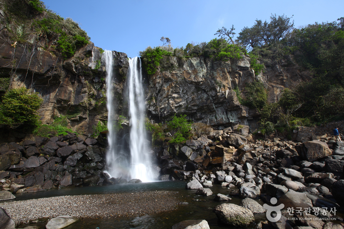
MorningCheonjiyeon Falls
A short paved walk from central Seogwipo through subtropical forest to a 22 m fall. Part of the island's UNESCO Global Geopark. Easy enough for any fitness level and a natural first stop of the day.
 Late morning
Jeongbang Falls
The only waterfall in Asia that drops directly into the sea — 23 m onto rocks with the ocean immediately beyond. A steep flight of steps down and back up; not step-free.
- Afternoon
Daepo Jusangjeolli Cliff
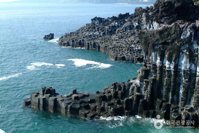
Hexagonal basalt columns rising from the sea, formed as lava from Hallasan met the water and fractured as it cooled. Ten minutes on a boardwalk, then as long as you want watching the swell hit them. Near the Jungmun resort area, so easy to pair with lunch.
- Rest of the day
Olle Trail Route 6, or the beaches
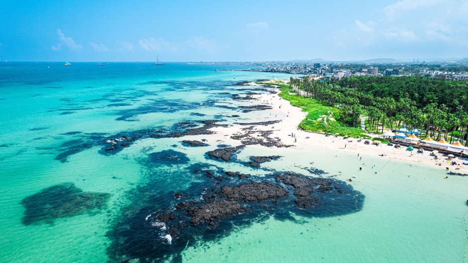
Route 6 runs about 11 km from Soesokkak into Seogwipo — the Olle organisation's own pick as the gentlest introduction, finishing in the middle of a town with food and buses. The 437 km Olle network is waymarked with blue arrows and pony markers rather than words, so it works without any Korean. If you would rather swim, Hyeopjae Beach on the west coast has the clearest water on the island.
Hallasan — or a gentler alternative
South Korea’s highest mountain at 1,947 m. The summit is a full day and needs a permit; the lower trails need neither.
Avoid: Winter without crampons
- Full day
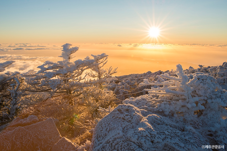
Hallasan summit
Only two trails reach the Baengnokdam crater lake. Seongpanak is 9.6 km each way and gentler, 8–9 hours round trip; Gwaneumsa is 8.7 km, steeper and more dramatic, 9–10 hours. Trailhead entry cut-offs are strict — 12:00 in winter, 12:30 in spring and autumn, 13:00 in summer — and it is day-hiking only, no camping. From December through February you need crampons; snow here is serious and trails close at short notice.
 Alternative
If the summit is not for you
The Eorimok, Yeongsil and Donnaeko trails climb the mountain to Witseoreum without reaching the summit, and need no reservation at all — half the scenery for a third of the effort. Or skip the mountain: Camellia Hill in the west flowers from late autumn through winter, when most of Korea has nothing in bloom.
More on the island
When to come
October is the strongest month — mild, dry, clear, with autumn colour on Hallasan. Mid-April to early June is the other good window, adding canola and cherry blossom. November is cool and quiet with excellent hiking. December turns cold and relentlessly windy, though Jeju is still the warmest part of Korea at 5–8 °C, and snow on Hallasan is a genuine draw — just note that snow can close the airport for hours, so keep slack before any onward flight. Avoid August and September if you can: that is peak typhoon season and Jeju sits directly on the track.
Where to stay on the island
| Jeju City | Next to the airport, with the most restaurants, the markets and the night life. Best for a short stay or without a car. |
|---|---|
| Seogwipo and Jungmun | The warm south coast: waterfalls, Olle trails and the big resort hotels of Jungmun. The base for the south and for Hallasan’s southern trails. |
| Seongsan and the east | Sunrise Peak, Udo ferries and the haenyeo divers. Quieter, with guesthouses and small hotels. |
| Aewol and Hallim in the west | Cafés on the coast road, Hyeopjae Beach and the best sunsets. Stay here with a car. |
Autumn and winter on Jeju
- Silver grass covers the oreum volcanic cones in October and November; Saebyeol Oreum is the famous one.
- Tangerine picking runs from about November to January at farms across the island, and is one of the best things to do with children.
- Camellias flower from December into early spring; Camellia Hill near Jungmun is the best-known garden.
- Winter is windy but mild by Korean standards, and the quietest, cheapest time for hotels.


Check what is on while you are here
Jeju runs its own festivals and exhibitions through the year. Put your dates into the Trip Planner, or browse everything on Jeju.
Jeju this weekendJeju: places & eventsParks & natureBeaches & islandsTrip Planner